Streetonomics – cultural street maps by Nokia Bell Labs
Our methodology, termed as "streetonomics", is a form of computational social science that studies human behavior and cultural trends through the quantitative analysis of street names.
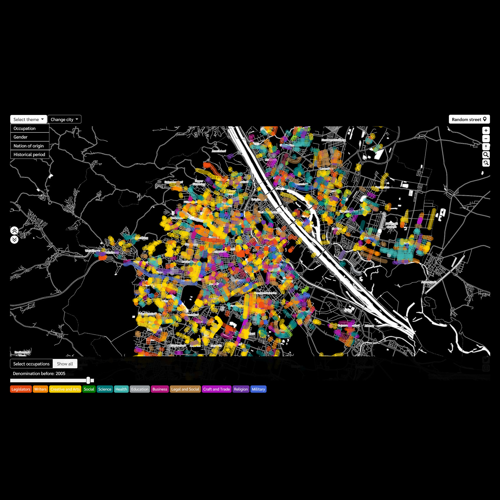
Throughout history, maps have been used as urban exploration tools. They visualize a city’s urban fabric through its streets, buildings, and points of interest. Besides purely navigation purposes, mapping street names unveils socio-cultural characteristics, reflects on the commemorative practices, and potentially raises citizens’ historical awareness.
But designing effective cultural maps is challenging, not only due to data scarcity but also due to the lack of effective approaches to engage citizens with urban data exploration. To address these challenges, we collected a dataset of 5000 streets across the cities of Paris, Vienna, London, and New York, and built their cultural maps grounded on cartographic storytelling techniques.
Cultural maps engage uses and allow them to discover distinct patterns in the ways these cities are gender-biased, celebrate various professions, and embrace foreign cultures. The visualization consists of five sections, ordered in a three-arc narrative sequence from
set-up through conflict to resolution to show street name patterns in each city and between cities. Interaction capabilities of cultural maps involve selections, map controls, button
for serendipitous discoveries and insight sharing.
-
CreditsLead Data Visualization Designer: Edyta Bogucka Lead Data Scientist: Marios Constantinides Data Visualization Developer: Wonyoung So Data Scientist: Melanie Bancilhon, Luca Maria Aiello, Daniele Quercia
-
Award
-
Categories
-
See more


