Berliner Straßennamen (Road Names in Berlin) by Cédric Scherer Data Visualization Design
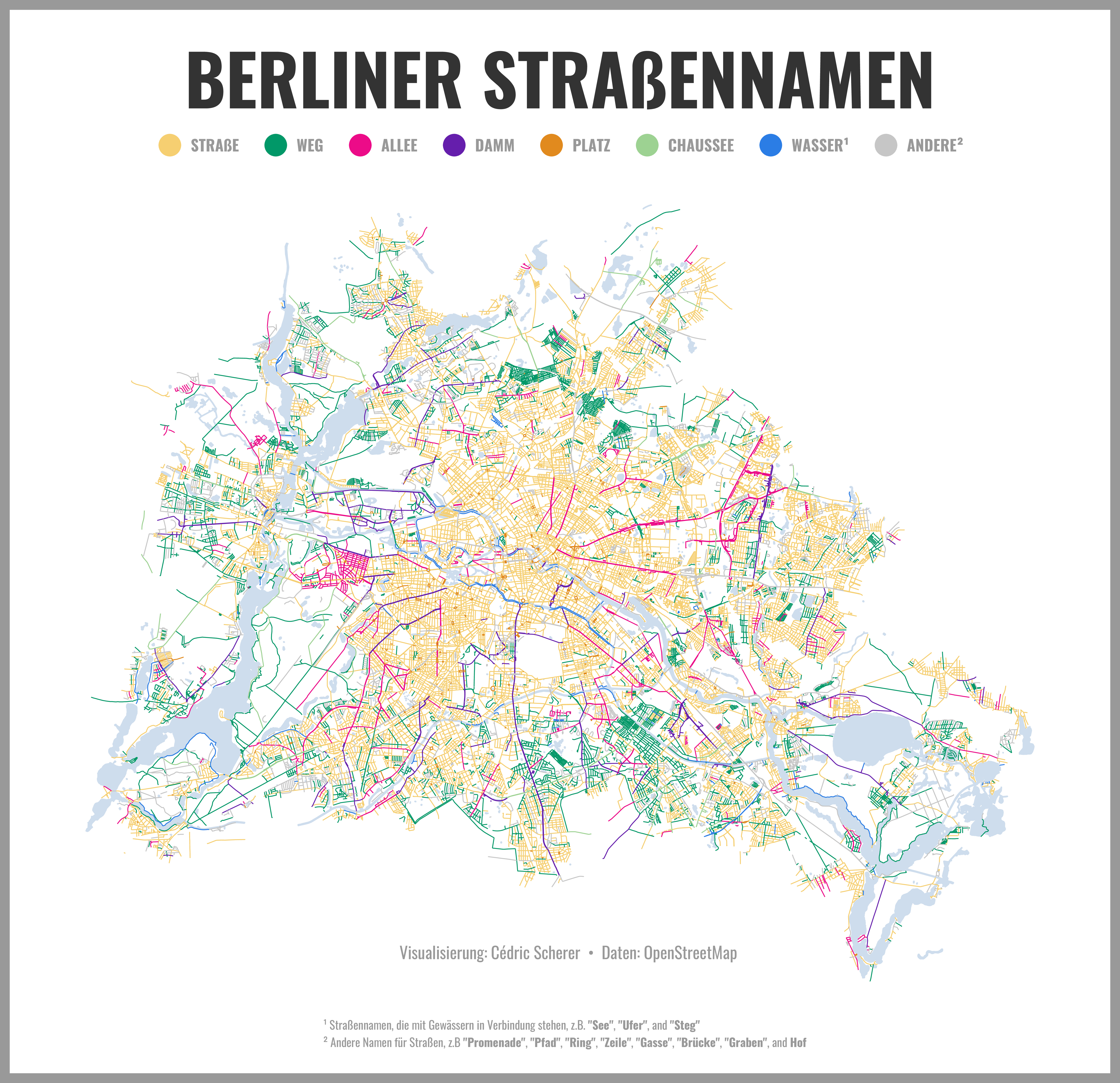
Often, road names have common suffixes or prefixes. The map illustrates the occurrence of popular road name types encoded by color.
The resulting colorful network reveals some interesting patterns. Obviously, names containing "Straße" (street, yellow) are found very often across all the city. Some others show distinct spatial clusters, especially "Weg" (path, dark green) and "Allee" (alley / avenue, light green). "Damm" (dam, purple) are often used for long roads that connect distant parts of the city. Less surprisingly, roads containing water-related words (blue) such as lake or shore are often find along rivers, lakes, and canals.
A German as well as an English version is available.
The maps were created as a personal contribution to the #30DayMapChallenge 2019. The visualization was completely created in R with ggplot2. The code and all versions are publicly available on GitHub.
-
Creditsnone
-
Award
-
Categories
-
See more


