How old are buildings in New York City? by George Koursaros
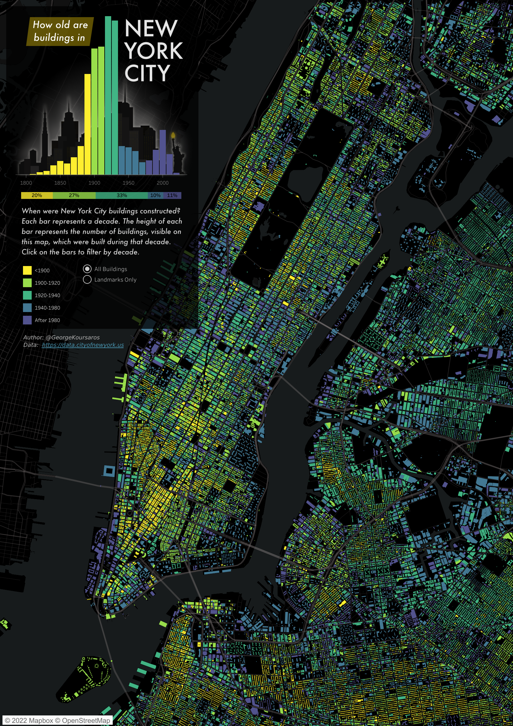
This data visualization explores the age of buildings in New York City by decade, from the early 1800s until the 2020s.
It uses geospatial data, tracing the blueprints of every building in NYC. You can filter the map to see all buildings or only landmarks and you can see the year each building was built and in the case of landmarks, its name.
You can filter the map by decade, so you can more clearly isolate the buildings of different eras. The bar chart in the top left clearly shows when there was a surge in real estate development in the city.
-
Credits
-
Award
-
Categories
-
See more


