GROW Observatory: Soil Moisture Maps by Moritz Stefaner
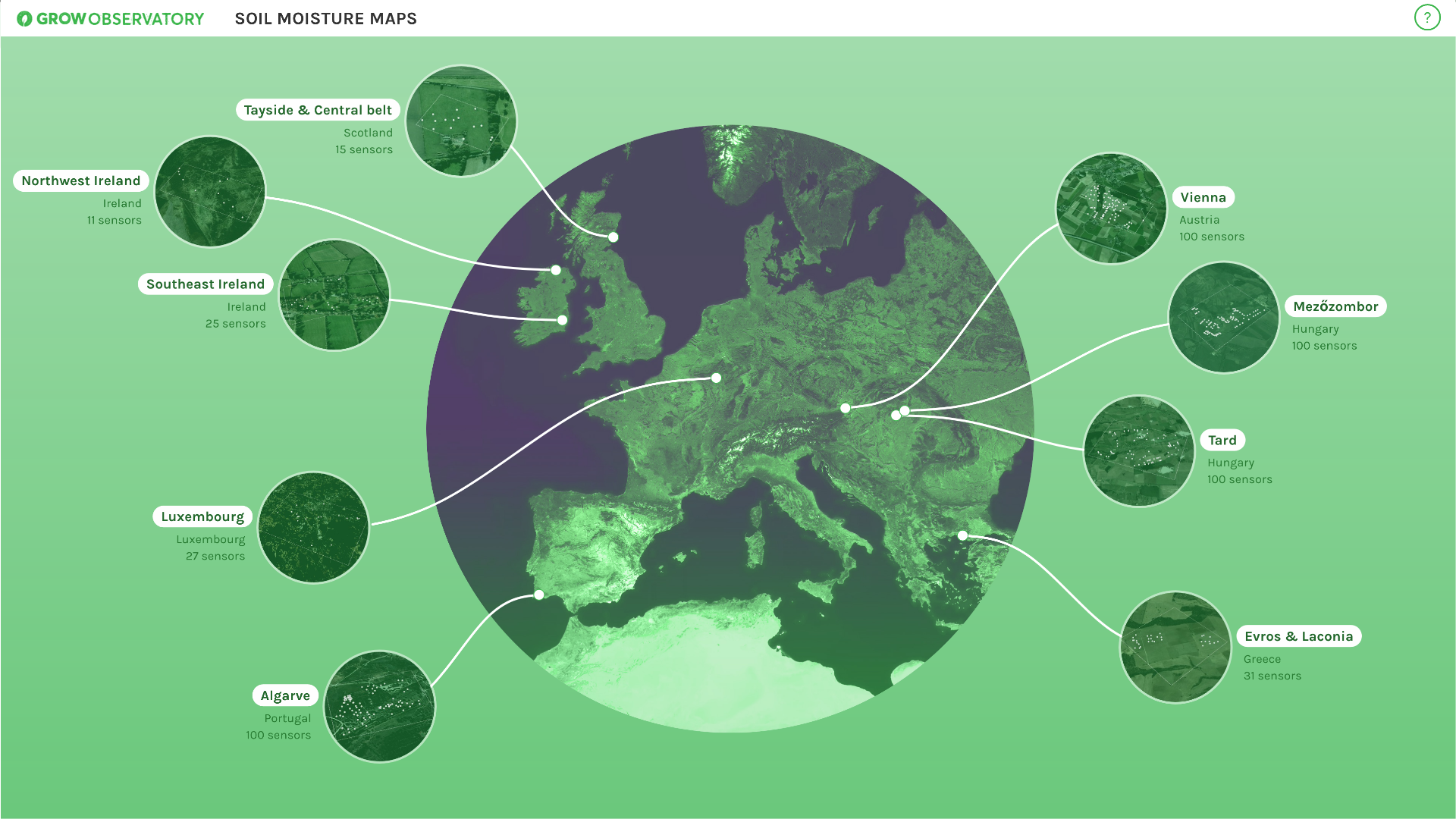
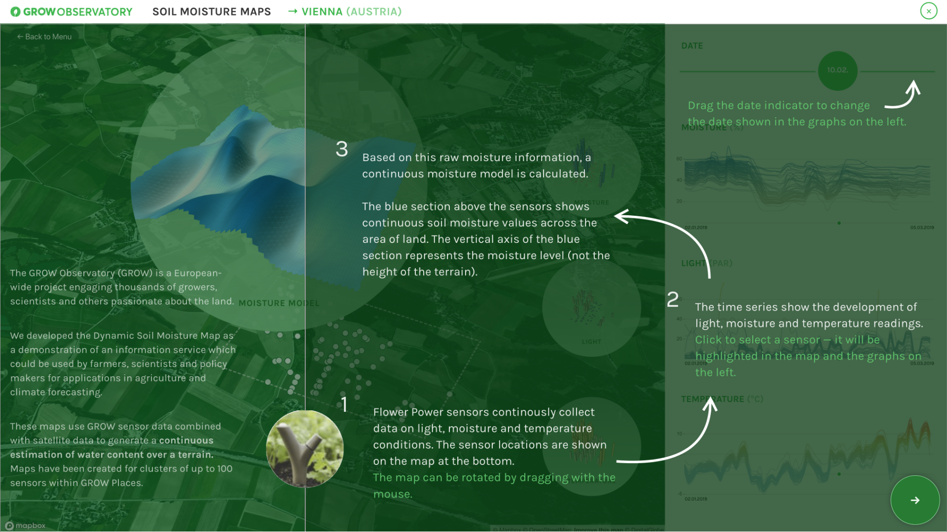
The GROW Observatory is a European-wide project engaging thousands of growers, scientists and others passionate about the land. For the Soil Moisture Maps project, we use local sensor and satellite data to generate a continuous estimation of water content over a terrain. Our interactive visualizations can be used by farmers, scientists and policy makers for applications in agriculture and climate forecasting.
The entrant has supplied multiple files for this project:
[1] [2] [3] [4] [5] [6] [7]
-
CreditsThe GROW Observatory Soil Moisture Maps have been developed by the GROW Observatory (https://growobservatory.org); Lead partner: FutureEverything; Data visualisation: Moritz Stefaner (Truth & Beauty) with Yuri Vishnevsky; Algorithms: IIASA and University of Miskolc; Data provided by: GROW community
-
Award
-
Categories
-
See more


