Stadtbilder by Moritz Stefaner, Dr Susanne Jaschko
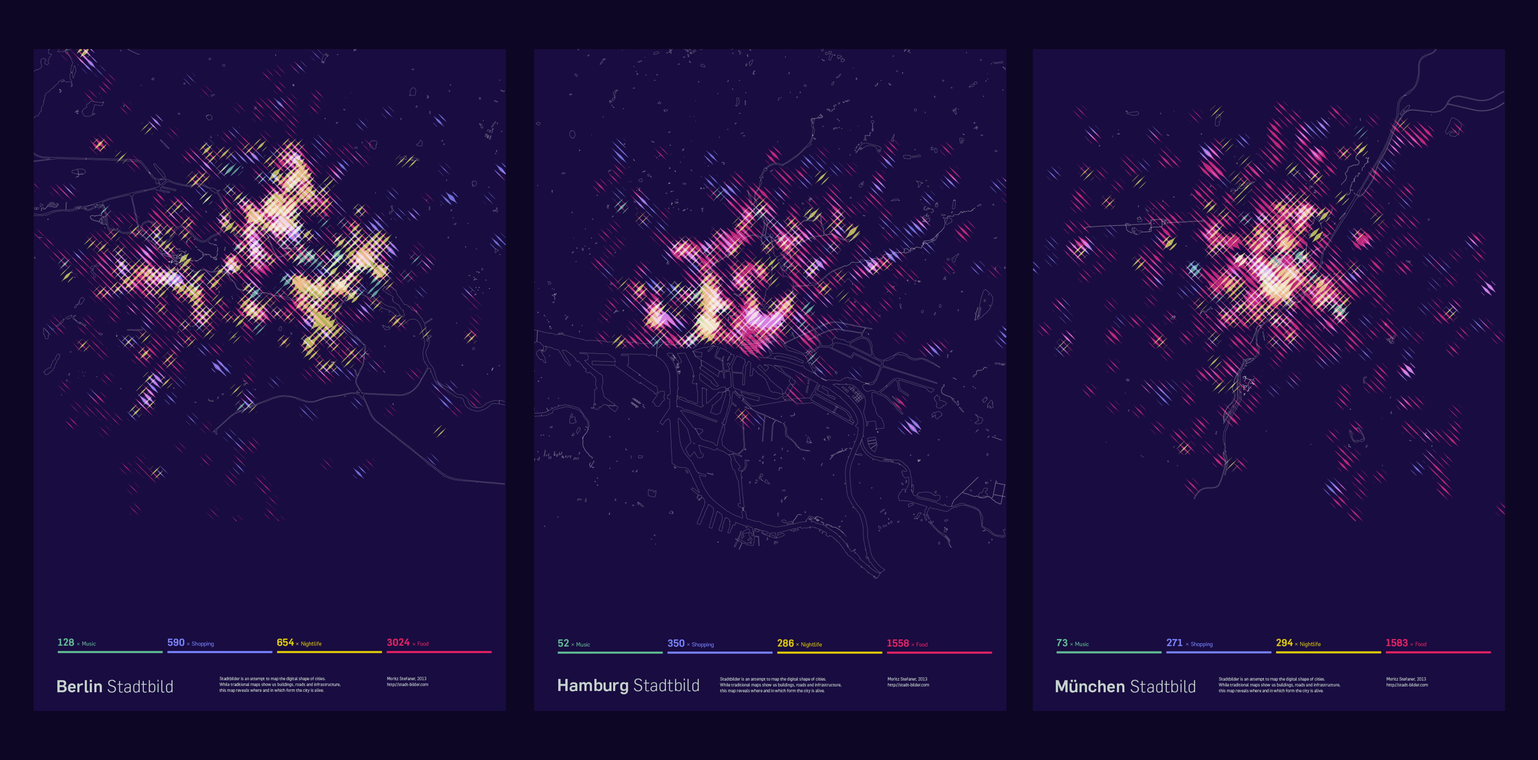
Stadtbilder is an attempt to map the digital shape of cities. While traditional maps show us buildings, roads and physical infrastructure, these maps reveal where and in which form the city is alive.
The maps show an overlay of all the digitally marked “hotspots” in a city, such as restaurant, hotels, clubs, etc. collected by uberblic.com, from various online services like yelp, or foursquare. What they don't show are the streets, the railroads, the buildings.
-
CreditsMoritz Stefaner
-
Award
-
Categories
-
See more


