August 28, 2100 by Dan McCarey, Maptian
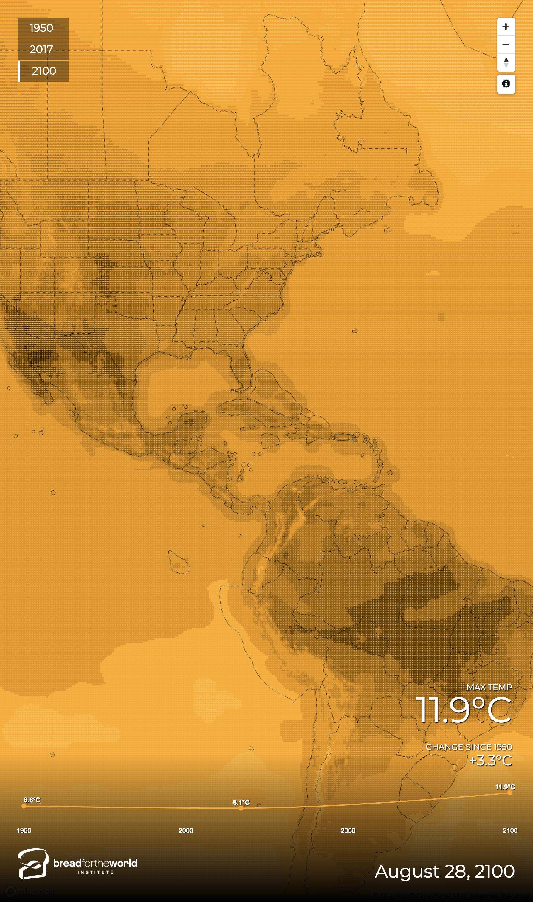
This map uses NASA data to visualize the estimated maximum near surface air temperature on August 28, 2100 at over a million points on the earth's surface. Users can compare the situation with historical data for August 28, 1950 to see how climate change is predicted to impact temperatures.
-
CreditsDan McCarey, Maptian
-
Award
-
Categories
-
See more


