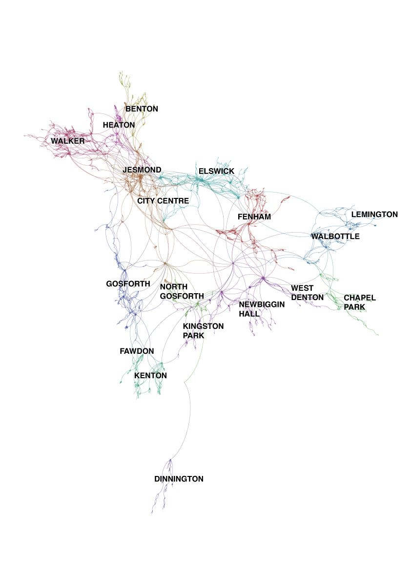
A Topological Road Map of Newcastle upon Tyne by Bruce Carlisle and Jon Swords, Northumbria University, UK.
In this piece we highlight long-held critiques of maps as truthful depictions of the world.
We place our trust in maps as truthful representations: as tools to guide us from A to B. But all maps are partial depictions made of elements cartographers deem significant. The unimportant and superfluous are erased.
In this map we have freed the streets and roads of Newcastle-upon-Tyne from their physical location and relationship to familiar sites which orientate us, preserving only the connections to other streets and roads. Data was sourced from Ordnance Survey's MasterMap Integrated Transport Network dataset. This information was then manipulated in ArcMap and Gephi, a social networking software package. An algorithm was used to generate gravity within the data based on shared connections. Collections of roads which are linked to each other are pulled together, while those which aren’t are pushed apart.
The result is a topological road map which is truthful in terms of how roads are connected (you could use it to navigate the city), but time and space are uncoupled from the layout. Using this map as a navigational tool, then, is akin to following a satnav where you know where you are in relation to road connections, but not in terms of an embedded, multi-sensory connection to the city.
Newcastle is disclosed as clusters of streets of different shapes, sizes and densities, which represent districts of the city. By not disclosing landmarks the map disorientates us to reveal the importance of familiar, often highly personal, sites that play important roles in how we understand, navigate and feel about the city.
This map was first exhibited at en_counter, an exhibition of maps and map art at The Holy Biscuit Gallery, Newcastle upon Tyne, May-June, 2016. For more details of the methodology see our forthcoming article in Environment and Planning A (pdf preview here).
-
CreditsBruce Carlisle and Jon Swords, Northumbria University, UK.
-
Award
-
Categories
-
See more


