Building Heights of England by Emu Analytics Limited
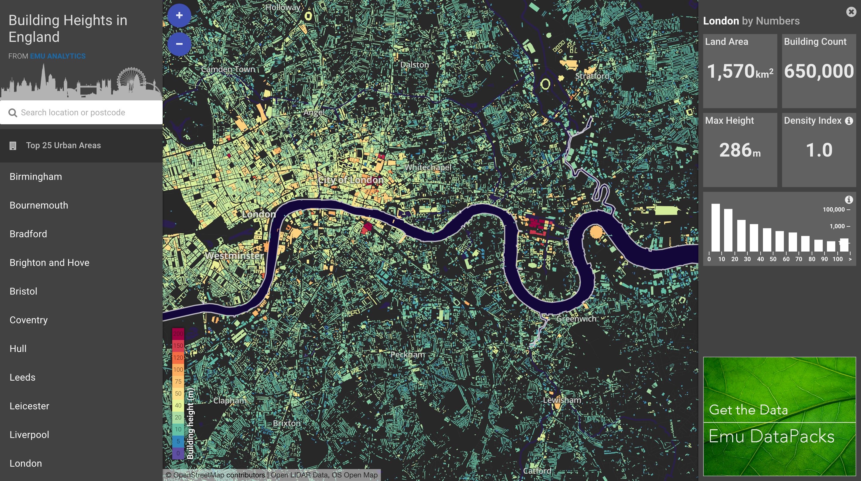
Heights of 13million buildings in England. Data is from LiDAR data & building outlines open data.
The visualization uses vector map tiles (from Open Street Map basemaps), MapboxGL, Angular JS, Angular Material and D3.
Zoom/Click a building to see geo co-ordinates, W3W address, height & area. On mouse-over a D3 height bar shows the relative building height.
Select an urban area to pan to that location for a series of aggregated metrics & height histogram for that polygon, animated using D3.
-
CreditsRobin Summerhill / Emu Analytics
-
Award
-
Categories
-
See more


